Tuesday, February 10, 2015

Arctic Cold, cold, COLD!!!!

Public weather briefing

After a somewhat mild day with snow showers moving through, look for cloudy conditions with patchy freezing drizzle/flurries to continue through the night. Much colder weather is in store for the rest of the forecast period as arctic air funnels in from the north. Not much in the way of precipitation, except a small chance on Friday with a weak clipper system passing through. Temperatures then plummet Friday night into the extended with cold wind chills Saturday morning.

Forecast 

Tonight. Mainly cloudy. A slight chance of freezing drizzle or flurries. Nearly steady temperature around 29. Southeast wind shifting to west after midnight.

Wednesday. Mostly cloudy. Early highs around 28, then falling though the rest of the day. Blustery. Northwest winds 10-20 mph, with gusts to 30 mph.  

Wednesday night. Mostly cloudy. A slight chance of snow showers. Low around 4. Continued breezy. Northwest winds 10-20 mph, with gusts to 30 mph. Wind chills around 10 below.  

Thursday. Partly cloudy and cold. High around 10 and low around 2. Wind chills between 5 and 15 below. 

Friday. Not as cold. Slight chance of snow showers. Highs in the low 20s. Lows near 0. Southwest winds shifting to the northwest late in the night.

Outlook for the Weekend and Monday. Saturday looks to be very cold with bitterly cold wind chills approaching advisory criteria of 25 below in the morning. Highs around 5 and lows in the mid teens below. Sunday, continued cold. Highs around 10 with a slight chance of snow showers. Monday. Not as cold with highs in the low 20s. [CONFIDENCE: MEDIUM TO HIGH]

Forecast Discussion

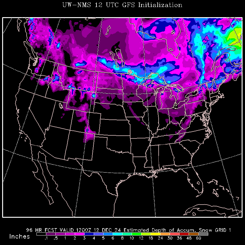
Tonight thru Wednesday night. Initial 500 mb vorticity maximum to move northeast of the area as the next one comes in late tonight. The area will remain under a cyclonic flow during this time keeping the clouds around and patchy freezing drizzle/snow showers into Wednesday. The pressure gradient tightens in response to the deepening cyclone to the east which will make for a breezy and colder day on Wednesday. Wind chills Wednesday night become a factor but should stay above advisory criteria. A third 500 mb vorticity maximum comes through wednesday night producing only a small chance of snow showers. 

Thursday. Skies should be clear in response to subsidence behind departing trough. 850 mb temperatures will start out around -20 C, then slowly moderate to -14 with weak warm air advection ahead of the next trough. This will make for a cold day with highs to struggle to reach 10. 

Friday through Monday. A northwest flow aloft will continue with a couple of vorticity maximums to note. The first to arrive early friday with a very slight chance of snow showers. This one will produce a cyclone and rapidly deepen it over the eastern US which will produce a strong pressure gradient over the area on saturday. 850 mb temperatures will plummet to around -28 C at 18Z Saturday and remain there with only a slight moderation into Sunday. Temperatures on Saturday could struggle to reach 5 with bitterly cold wind chills. Highs Sunday will be around 10 with lighter winds. Temperatures will moderate some what by Monday with highs in the 20s. 

Ross Braatz
Brandon Lipp

Monday, February 9, 2015

Colder Weather on the Way

Public weather briefing

The weather will be fairly docile Tuesday, with seasonal temperatures. A cyclone to the west will bring warm air into the area on Wednesday, resulting in highs around 35. The central low will will most likely pass north of Madison, resulting in only flurries. After the cyclone passes temperatures will cool significantly. Highs will be only in the teens on Thursday, and will likely remain in the teens and single digits through the weekend.

Forecast 

Tonight. Clear to partly cloudy skies. Winds out of the northeast, dying down as the night goes on. Low around 10.

Tuesday. Mostly Overcast skies, with winds out of the southwest at 5-10 mph. Highs in the upper 20s.

Tuesday night. Cloudy skies continue. Low in the mid 20s.

Wednesday. Overcast skies. Winds around 10-15 mph. A chance for flurries. High around 35, low around 25.

Thursday. Continued clouds, a potential for some snow. High of 14, low of 11.

Outlook for Friday through Sunday. Partly cloudy through out the weekend. Temperatures will be cold. High of 17 on Friday, around 10 on Saturday and around 15 Sunday. Overnight lows will be in the single digits or below zero. [CONFIDENCE: MEDIUM]

Forecast Discussion

A clipper system coming in from Canada will dominate our weather this week. As it approaches our area on Wednesday there will be significant vorticity advection to our north, and much weaker advection in the Madison area. Madison is likely to see some Flurries from the resultant vertical motion, northern Wisconsin has the potential to see six inches of snow. After the cyclone passes, it will intensify to our east, causing strong cold air advection, resulting in below normal temperatures from Thursday on.

The potential for error in our forecast hinges on the track of the cyclone as it passes through Wisconsin. However, the models have held its track fairly steady for the past few days. Another potential issue is the track and intensity of a cyclone coming through from the north on Thursday.

Brandon Lipp
Ross Braatz

Thursday, February 5, 2015

Pleasent Days Ahead


Public weather briefing

After a terribly cold Thursday with clear skies, and temperatures below 20, we look to be warming significantly in the next couple of days. Lows tonight will be in the single digits and below zero wind chill. Friday will warm up significantly and be able to maintain much more mild overnight temperatures with lows holding around 20. By Saturday highs will be in the upper 30s with a chance for snow and possibly light rain on Sunday. Early next week expect high temperatures to stabilize in the upper 20s and partly cloudy conditions will persist. 

Forecast 

Tonight. Clouds begin to move in. Lows sitting around 10.

Friday. Partly sunny with light winds. High of 28.

Friday night. Partly cloudy.  Lows up around 20.

Saturday. Partly Sunny and warming. Moderate winds out of the southwest. Highs in the upper 30ls. Low around 25 with clouds moving in overnight.

Sunday. Small chance of precipitation in the form of a wintery mix. Cooling overnight in the mid 10s.

Outlook for Monday through Wednesday. Mild temperatures with the possibility of precipitation on Tuesday with warmer temperatures in the upper 20s. Wednesday night looks to bring much cooler temperatures with and overnight low in the single digits. [CONFIDENCE: MEDIUM]

Forecast Discussion

Southwesterly flow over the mountains will force widespread adiabatic warming, maintaining moderate temperatures in Central United States. The combination of these cold and warm air masses will compress the temperature gradient across the Northern United States, forcing an overturning in the leading edge of the front. This will support upward vertical motion via a thermally direct circulation and bring a decent chance for snowfall for the Northern States. Heading into early next week, the temperature gradient will have maxed out and stabilize as it propagates to the east. Stable conditions will follow for the local area with mild temperatures.

http://cup.aos.wisc.edu/GIFA/2196SNFL.gif


Ryan Tvedt
Samuel Hartwick

Wednesday, February 4, 2015

Canadian Airmass in Place Until Friday

Public weather briefing

After a significant cool down and some decent snowfall, skies will clear and temperatures will continue to drop before recovering as we head into the weekend. Lows tonight will be well below zero and will remain in the single digits for Thursday night. By Saturday highs will be in the mid to upper 30s with a chance for snow and possibly light rain. Possibility for rain increases heading into Sunday. Early next week expect high temperatures to stabilize in the mid 20s and partly cloudy conditions. 

Forecast 

Tonight. Clearing with light northerly winds. Lows diving down well below 0.

Thursday. Mostly sunny with light winds. High around 15.

Thursday night. Partly clear and cold.  Lows dipping back to the single digits.

Friday. Partly Sunny and warming. Moderate winds out of the southwest. High of 30. Low around 20 overnight.

Saturday. More clouds roll in, but greater warming brings temperatures in the mid to upper 30s.

Outlook for Sunday through Tuesday. Mild temperatures and partly cloudy skies on Friday, possibility of precipitation with warmer temperatures in the upper 30s Saturday. Increasing chance for light snow into Sunday with highs in the upper 20's. Monday highs return to the mid 20s with partly cloudy conditions. [CONFIDENCE: MEDIUM]

Forecast Discussion

Heading into the overnight hours, clearing skies and winds out of the northeast will advect a cold air mass and add to the effect radiational cooling. These factors will cause temperatures to plummet. Southwesterly flow over the mountains will force widespread adiabatic warming, maintaining moderate temperatures in Central United States. The combination of these cold and warm air masses will compress the temperature gradient across the Northern United States, forcing a frontogenetical circulation. This will support upward vertical motion and bring a decent chance for snowfall for the Northern States.

http://tempest.aos.wisc.edu/wxp_images/eta212_12UTC/eta_c850_h57.gif


Ryan Tvedt
Samuel Hartwick

Tuesday, February 3, 2015

Aftermath From Snow Storm: Freezing Temps

Public weather briefing

After the current snow storm made its way through Madison, cold air moves in. Below zero temperatures are in store for Wednesday night, which will lead into a very cold Thursday with highs expected around 10 degrees.  It will be mostly clear for the next two days before the next system moves through bringing possible precipitation and warming temperatures.  Highs for the weekend are expected to be in the middle to upper 20s and possibly hit 30.  Along with this likely comes mixed precipitation,  however, on Saturday and Sunday.

Forecast 

Tonight. Slight chance of snow showers after the initial snow storm, before clearing out in the night.  Low around 7 degrees with light winds.

Wednesday. Some clouds and sunny with light northwest winds.  High around 18 degrees.

Wednesday night. Clear and frigid.  Low around -10 degrees with light winds.

Thursday. Sunny and cold. Light winds with negative wind chills. High around 10. Low around 5.

Friday. Clear very early then mostly cloudy and warmer.  High near 30 with a light south wind.  Low just under 20.

Outlook for Saturday through Monday. Mostly cloudy with a chance of precipitation on Saturday and Sunday before clearing out to a partly sunny Monday.  Highs consistently in the middle to upper 20's with a low around 20 on Saturday cooling to a low around 10 Sunday and Monday [CONFIDENCE: MEDIUM]

Forecast Discussion

Currently, a snow storm is in area producing moderate accumulation totals.  This band is moving quickly, but producing snow at a heavy rate and some areas could be seeing 3 inches or more. 
This sounding from Davenport, Iowa this morning is a view of the atmosphere.  It is showing high moisture levels in the lower atmosphere from the surface to 850 mb.  The high levels of precipitation associated with this storm is likely due to a upward vertical velocity maximum centered in the area of the sounding as well as frontogenetical forcing.

Trailing behind the low pressure system, an anticyclone from southern Canada moves down into the northern midwest bringing clear conditions and very cold temperatures.  These conditions will last from Wednesday afternoon to early Friday, before the system moves through and a secondary trough moves into the area from Canada bringing up the next possibility for precipitation.  

Associated with this trough, is warm air advection rising the temperatures from the 10's to the middle to upper 20's.  With this rise in temperature, the type of precipitation is still unsure, so we expect the possibility of mixed precipitation on Saturday and more likely snowy conditions on Sunday if precipitation occurs due to the cooling temperatures.


Will Hahn and Andrew Goenner

Monday, February 2, 2015

More Snow On The Way

Public weather briefing

After a snowy weekend bringing in the most snow we have seen all season, more snow is likely on the way. A clear Monday will give way to more snow Tuesday afternoon and into the early hours of Wednesday.  Accumulation should be small at likely less than an inch of total snowfall.  Temperatures will get very cold in the mid week as lows are expected around 0 degrees or colder on Wednesday night due to the clearing conditions.  Highs will be chilly as well before rising at the start of the weekend and getting into the mid 20's.  There is slight chance of snow this weekend on Saturday and Sunday, it will be something to watch for as the week continues.

Forecast 

Tonight. Mostly cloudy tonight with mild southwest winds. Low between 0-5 degrees.

Tuesday. Mostly cloudy before flurries and snow in the later afternoon. Light winds and a high near 20.

Tuesday night. Continued snow until the very early morning accumulating to less than an inch.  Low around 10.

Wednesday. Mostly cloudy before clearing out later. Moderate northwest winds. High near 20. Low of -10.

Thursday. Mostly sunny. Light to moderate southwest west wind. High just above 10 degrees.

Outlook for Friday through Sunday. Cloudy throughout the weekend, with a very slight chance of snow.  Highs in the mid to high 20's, becoming almost 30 on Saturday.  Lows in the mid teens. [CONFIDENCE: MEDIUM]

Forecast Discussion

At the moment, middle to high clouds are prominent along with warm air advection aloft.

This will develop further and become more prominent into Tuesday.  On Tuesday, a vorticity maximum interacts with a baroclinic zone in the upper atmosphere producing negative omega values over southern Wisconsin/northern Illinois.  From this system, Madison will receive a light amount of snow with accumulation totals likely less than an inch.


After this minor system passes by, an anticyclone moves into the area creating positive omega values and clearing conditions.  Strong cold air advection from central Canada will cause very cold temperatures and along with the clear conditions will cause lows into the negatives on Wednesday night and highs near 10 degrees on Thursday.  The National Weather Service hasn't issued any wind chill advisories or warnings yet, indicating light winds along with the cold temperatures.


Into the weekend, a frontal zone sets up and allows for the possibility of more snow and warming conditions.  Right now, forecast (NAM/GFS) models show light to moderate snowfall.

Will Hahn and Andrew Goenner